
轨迹纠偏类接口为开发者提供轨迹去噪、抽稀、绑路功能,包括实时位置纠偏、轨迹纠偏、里程计算功能。
目前中国主要有以下三种坐标系:
WGS84:为一种大地坐标系,也是目前广泛使用的GPS全球卫星定位系统使用的坐标系
GCJ02:是由中国国家测绘局制订的地理信息系统的坐标系统。由WGS84坐标系经加密后的坐标系
BD09:为百度坐标系,在GCJ02坐标系基础上再次加密。其中bd09ll表示百度经纬度坐标,bd09mc表示百度墨卡托米制坐标
非中国地区地图,统一使用WGS84坐标
简介:查找entity最近一个轨迹点,支持实时纠偏。
支持功能:返回entity最新的实时位置(支持纠偏)、速度、方向、高度、定位精度、定位模式、交通方式等信息。
适用场景:适用于持续追踪某一终端,实时展示最新的纠偏后轨迹点。
https://yingyan.baidu.com/api/v3/track/getlatestpoint
//GET请求
返回值
https://yingyan.baidu.com/api/v3/track/getlatestpoint?service_id=1000&entity_name=小明&coord_type_output=bd09ll&process_option=denoise_grade=1,radius_threshold=20,need_mapmatch=1,transport_mode=driving&extensions=road_info&ak=你的'''AK'''
{"status": 0,"message": "成功","latest_point": {"longitude": 116.43683174878,"latitude": 40.079614535339,"loc_time": 1521120545,"direction": 81,"height": 21,"radius": 7,"speed": 7.142739,"locate_mode": "GPS/北斗定位","transport_mode": "驾车"}}
简介:查询entity 一段时间内行驶里程。
支持功能:1. 支持计算一段时间内轨迹纠偏、补偿后的总里程,也支持计算原始轨迹里程;2.支持对中断的轨迹区间进行里程补偿,支持使用直线或驾车/骑行/步行路线规划的里程进行补偿。
适用场景:1. 通用型的原始和纠偏后轨迹里程计算;2. 应用于网约车、物流等行业的用车实时计费,通过纠偏和补偿后的里程,校准用车计费。
https://yingyan.baidu.com/api/v3/track/getdistance
//GET 请求
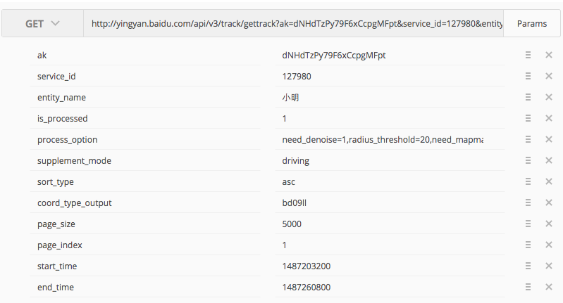
https://yingyan.baidu.com/api/v3/track/getdistance?ak=<用户的AK>&service_id=<用户的SERVICE_ID>&entity_name=小明&is_processed=1&process_option=denoise=1,radius_threshold=20,need_mapmatch=1,transport_mode=driving&supplement_mode=driving&low_speed_threshold=20&start_time=1487203200&end_time=1487260800
{"status": 0,"message": "成功","distance":"3634.7","low_speed_distance":"349.3"}
简介:查询一个时间段内一个entity的连续轨迹信息,并进行纠偏。
支持功能:支持对一段轨迹进行纠偏、绑路、补偿中断区间道路、分析起终点、计算总里程和收费里程。其中每一个轨迹点的信息包括:坐标、速度、方向、高度、定位精度、定位模式、交通方式等。
适用场景:适用于查询一段时间的轨迹并进行纠偏,解决轨迹缺失与漂移问题,这也是开发者最常使用、最依赖鹰眼的一个场景。
https://yingyan.baidu.com/api/v3/track/gettrack
//GET 请求
注意:拷贝示例代码后,请在代码中填入您的serviceID再运行;
{"status": 0,"message": "成功","total": 10156,"size": 100,"distance": 70101.769271664,"toll_distance": 0,"start_point":{"longitude": 121.47756835641,"latitude": 31.228864478309,"loc_time": 1487210008},"end_point":{"longitude": 121.66034736775,"latitude": 31.145494901873,"loc_time": 1487260798},"points":[{"loc_time": 1487210008,"latitude": 31.228864478309,"longitude": 121.47756835641,"create_time": "2017-02-16 09:53:56","direction": 160,"height": 5,"key1": "value1","radius": 10,"speed": 6.8,"locate_mode": "GPS/北斗定位","transport_mode": "驾车"},{"loc_time": 1487210013,"latitude": 31.228900948179,"longitude": 121.47727614458,"create_time": "2017-02-16 09:53:56","direction": 0,"height": 36,"key1": "value1","radius": 10,"speed": 0,"locate_mode": "GPS/北斗定位","transport_mode": "停留"},...{"loc_time": 1487210503,"latitude": 31.232230380323,"longitude": 121.47848441484,"create_time": "2017-02-16 10:02:09","direction": 228,"height": 6,"key1": "value1","radius": 5,"speed": 1.87,"locate_mode": "GPS/北斗定位","transport_mode": "停留"}]}
上一篇
下一篇
 没有match的答案?试试对话大模型